| Lectures |
Stilla U (2012-07-19) Welcome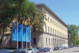 Thanks to the initiative and support of Prof. Jon Atli Benediktsson,
GRSS President, the administrative committee (AdCom) of GRSS has started
to plan summer schools mainly intended for BS, MS and PhD students
in conjunction with the society's flagship event,
the IEEE International Geoscience and Remote Sensing Symposium (IGARSS).
Due to the success of similar examples in other IEEE societies,
the first IEEE GRSS summer school is organized by Prof. Uwe Stilla and his team at
Technische Universitaet Muenchen (TUM). Due to limited available space,
from 116 initial registrations from 25 different countries,
70 registrants from 20 countries were invited to participate at RSSS12.
All will receive a certificate confirming their attendance to the summer school.
----- Goodenough DG (2012-07-19) Methods and Systems for Forest Applications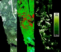 In order to monitor the resources and environment of the planet, it is necessary to use remote sensing from multiple sensors and integrate these data with historical information contained within geographical information systems (GIS). Multiple sensors are required to identify attributes of interest. In forestry, resource managers want to know the amount of the resource by species, area, timber volume, etc., the spatial distribution, the health (chemistry) of the forests, and the temporal changes of the resource, both past and predicted for the future. The technologies of the IEEE Geoscience and Remote Sensing Society are used to create information systems to support resource and environmental management. In this presentation we describe hyperspectral and radar methods and systems to obtain valuable forest information, such as chemistry, above-ground carbon, species, and biomass. Polarimetric satellite radars can be used to detect and map current and historical fire scars. Radars provide all-weather monitoring capability and estimates of biomass. National and global monitoring requires systems for distributed data management. We have created a system (www.saforah.org) using GRID architecture, optical light paths, and petabyte data stores at the University of Victoria. SAFORAH serves out to the public and research community remotely sensed data of Canada and forest information products for land cover, biomass, and change. Hyperspectral sensing is used to obtain species distribution and forest chemistry. Examples of this work for forest applications and the generation of above-ground products are presented. We will also discuss operational issues in monitoring forests.
----- Bruzzone L (2012-07-19) Challenges in the analysis of multitemporal remote sensing images In the last decade a large number of new satellite remote sensing missions have been launched resulting in a dramatic improvement in the capabilities of acquiring images of the Earth surface. This involves an enhanced possibility to acquire multitemporal images of large areas of the Earth surface, with improved temporal and spatial resolution with respect to traditional satellite data. Such new scenario significantly increases the interest of the remote sensing community in the multitemporal domain, requiring the development of novel data processing techniques and making it possible to address new important and challenging applications. After a general overview of the problems related to the analysis of multitemporal images, this talk will focus on the crucial problem of automatic change detection between multitemporal images. The development and the use of effective automatic techniques for change detection are of major importance in many application scenarios. The increased geometrical resolution of multispectral and SAR sensors, the increased revisit time of high resolution systems, and the expected availability of time series of hyperspectral images in the near future result in many different methodological problems as well as in very important new possible applications. The talk will address these problems by pointing out the state of the art and the most promising research directions for change detection on images acquired by the last generation of satellite sensors. Examples of the use of change-detection approaches in real scenarios will be provided.
----- Crawford M (2012-07-19) Advanced methods for classification of hyperspectral data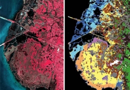 Increased availability of hyperspectral imagery and greater access to advanced computing provide opportunities and challenges for development and application of advanced classification methods that more fully exploit the unique characteristics of these data. While the hundreds of narrow spectral bands allow detailed characterization of spectral responses and provide greatly improved capability for atmospheric correction, band redundancy is problematic. Additionally, supervised classification methods require ground reference information, which is difficult and expensive to acquire, particularly for inaccessible areas, and spectral signatures of the same class often vary with location and/or time. These problems are further exacerbated by the high dimensionality of hyperspectral data, which necessitates collection of a large number of training samples to properly represent class distributions, and by the sensitivity of narrow bands to spectral drift across space and time. This lecture will focus on strategies for dealing with these issues. Linear and nonlinear feature extraction methods will be presented as means of dimensionality reduction. Semi-supervised learning will be explored for exploiting unlabeled data when labeled data are scarce. Active learning heuristics will be introduced as strategies for better utilizing existing labeled data and providing guidance for efficient acquisition of additional labeled information for the classification problem. Examples will be provided from airborne and space-based Hyperion hyperspectral data.
----- Chanussot J, Plaza A (2012-07-19) Hyperspectral image and signal processing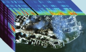 Acquiring the same scene using hundreds of narrow and contiguous spectral bands, hyperspectral images offer an invaluable diversity of information, enabling the accurate physical description and discrimination of the sensed materials. Over the past decade, hyperspectral remote sensing became more and more popular, with a blooming number of available sensors, for airborne or satellite platforms. More and more applications are addressed using such data, from precision agriculture, to the monitoring of the environment and natural hazards, mining industry, forestry or defense related issues. However, exploiting these very high dimensional data where each pixel is represented as a vector with several hundreds components is very
challenging and specific image and signal processing methods must be developped. The goal of this short course is to introduce some of the most classical issues and standard approaches.
This includes:
----- Stilla U (2012-07-20) SAR Urban Remote Sensing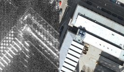 New synthetic aperture radar (SAR) sensors on satellites like TerrsSAR-X allow flexible mapping with a large coverage or a high resolution of about one meter. Leading-edge airborne SAR sensors provide spatial resolutions on the order of a decimetre. In such data, many features of urban objects can be identified, which were beyond the scope of radar remote sensing before. But, SAR images are often really difficult to be interpreted: the presence of speckle as well as of some distortion effects, like shadowing and layover, makes the analysis of this kind of image complex. The impact of high resolution SAR data on the analysis of urban scenes and typical SAR effects are discussed. Examples for the appearance of buildings and other man-made objects are given. The benefit of SAR-simulation is addressed and examples are shown. Finally, typical problems in SAR simulation are discussed.
----- Gamba P (2012-07-20) Multispectral Urban Remote Sensing and Data Fusion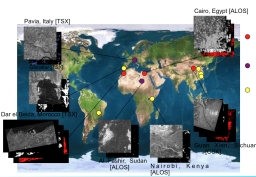 This tutorial will describe the aim and main methodologies involved in the use of Earth Observation data to monitor, characterize and analyze human settlements. Human settelements are very complex environments, and can ben described at multiple geographical scales. Examples of different applications, including settlement monitoring, road network extraction and building characterization will be provided, as well as a general framework to extract and fuse multiscale features from multisource data for urban remote sensing. Focus will be mostly on VHR data, but coarse resolution data will be also considered for applications at the regional/global level. At the end of this tutorial the students will be able to select the most suited data set for a specific urban remote sensing application, and design a system to solve a task addressing a urban problem by means of EO and other ancillary data.
----- Bamler R (2012-07-20) SAR Interferometry and Tomography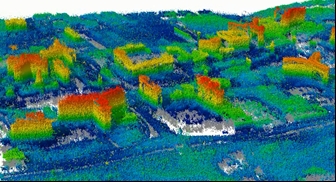 SAR interferometry (InSAR) has become a universal tool for many Earth observation applications like DEM generation, deformation and subsidence measurements, and assessment of volcanic and tectonic activities.
This lecture gives an introduction to the classical InSAR technique for DEM generation as well as to more advanced new developments, like PSI and SAR tomography. These new methods enable exciting measurements of building shapes and their deformation or subsidence with accuracies down to 1mm/year. The following topics will be discussed:
SAR interferometry (InSAR) has become a universal tool for many Earth observation applications like DEM generation, deformation and subsidence measurements, and assessment of volcanic and tectonic activities.
This lecture gives an introduction to the classical InSAR technique for DEM generation as well as to more advanced new developments, like PSI and SAR tomography. These new methods enable exciting measurements of building shapes and their deformation or subsidence with accuracies down to 1mm/year. The following topics will be discussed:- imaging geometries of the different InSAR configurations - the concept of coherence and phase noise - baseline decorrelation and critical baseline - differential InSAR and PSI - correlation techniques - introduction to multibaseline InSAR and tomography All the concepts will be illustrated by examples from ERS, ENVISAT, SRTM, TerraSAR-X and TanDEM-X data. ----- Marpu P, Dalla Mura M (2012-07-20) Morphological Profiles and Attribute Profiles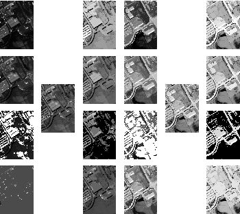 Very high resolution (VHR) images are one of the most striking results of the latest technological advances in remote sensing. When dealing with images of meter or submeter geometrical resolution, the spatial information is of fundamental importance. In fact, owing to this improved spatial resolution, the geometrical features of the structures in a scene become valuable information for characterizing objects in the scene (e.g., for object extraction) or increasing the capability of discrimination between different land-cover classes (e.g., in a classification task).
This tutorial is devoted to present one of the most successful strategies for extracting spatial features in remote sensing images, the Morphological Profiles (MPs). MPs have been proved to be powerful tools to model the spatial information (e.g., contextual relations) of the image through the extraction of structural features (e.g., size, geometry, etc.) from the objects present in the scene.
In this lecture, we will also address Attribute Profiles (APs), a recent extension of the MP concept, which permit to model and extract spatial information with a greater flexibility compared to MPs, further increasing their potential in modeling spatial features.
We will also demonstrate the use of MPs and APs in practical remote sensing applications (e.g., classification, object detection, segmentation, change detection, etc.) and considering different types of remote sensing images (e.g., panchromatic, multispectral, hyperspectral, polarimetric SAR and LIDAR).
|


 Lectures