
")

- Stilla U (2009-12-08) Challenges in enrichment and automatic texturing of 3d building models by terrestrial and airborne IR video. Sino-German Workshop 'Dynamic Maps'.China, Wuhan
- Stilla U (2009-12-07) Chair of session: Modeling. Sino-German Workshop 'Dynamic Maps'.China, Wuhan
[Session program][Photo] - Stilla U (2009-11-19) Full Waveform Laserscanning - Auswertemethoden und Anwendungen. Terrestrisches Laserscanning (TLS 2009). 91. DVW-Seminar, Fulda
- Stilla U (2009-11-12) IR-Texturierung von 3D-Gebäudemodellen zur thermographischen
Inspektion von Stadtquartieren. Geodätische Kolloquium, Berlin, Technische Universität - Stilla U (2009-11-03) Full Waveform Laser Scanning: Technologie, Datenprozessierung und Anwendungen. Geodätische Kolloquium, Hannover, Leibniz Universität
[Geod. Koll. Hannover 09WS] - Iwaszczuk D (2009-10-06) Anreicherung der Gebäudehülle mit Oberflächenstrukturen in CityGML. AgA Automation in der Kartographie. Frankfurt, Bundesamt für Kartographie
- Selby (2009-10-02) An X-ray and computed tomography based registration method for patient to beam alignment designed for high reliability despite of degraded X-Ray image quality. PTCOG 48. Heidelberg
[Poster] - Yao W (2009-09-24) Traffic Monitoring of Large-Scale Urban Areas using Airborne LiDAR. Transportation Research Center(TRC). China, Wuhan
- Yao W (2009-09-23) Traffic Monitoring of Large-Scale Urban Areas using Airborne LiDAR. Urban Remote Sensing Workshop. China, Wuhan
- Stilla (2009-09-22) High resolution thermal mapping of buildings using 3D city models. Sino-German Workshop 'Urban Remote Sensing and Surveying'. China, Wuhan
- Stilla (2009-09-22) Chair of session: PS-InSAR / D-InSAR. Sino-German Workshop 'Urban Remote Sensing and Surveying'. China, Wuhan
[Session program][Photo]
- Stilla U (2009-09-04) Closing. CMRT09 - City Models, Roads and Traffic. France, Paris
- Hebel M (2009-09-04) Utilization of 3D city models and airborne laser scanning for
terrain-based navigation of helicopters and UAVs. CMRT09: City Models,
Roads, and Traffic. France, Paris - Stilla U (2009-09-04) Chair of session:.SAR. CMRT09 - City Models, Roads and Traffic. France, Paris
[Session program][Photo] - Stilla U (2009-09-03) Opening. CMRT09 - City Models, Roads and Traffic. France, Paris
[Session program][CMRT09 Gallery][Photo01][Photo02] - Stilla U (2009-06-03) Chair of session: Classification and Tracking. ISPRS Hannover Workshop 2009 Hig-resolution earth imaging for geospatial information, Hannover
[Session program] - Schmitt M (2009-06-03) Registration of multi-aspect VHR SAR images of inner city areas. ISPRS Hannover Workshop 2009 High-resolution earth imaging for geospatial information, Hannover
- Kolecki J (2009-06-03) Texture mapping of 3D building models with oblique direct geo-referenced airborne IRimage sequences. ISPRS Hannover Workshop 2009 High-resolution earth imaging for geospatial information, Hannover
- Yao W (2009-05-27) Unveiling Short-Term Dynamic of Urban Areas with Airborne LiDAR Data for Change Detection. (EOGC 2009) China, Chengdu
- Stilla U (2009-05-22) Problems and challenges of road extraction from very high resolution SAR images. Invited talk. Joint Urban Remote Sensing Event. (JURSE 2009). China, Shanghai
- Stilla U (2009-05-22) Thermal leakage detection on building facades using
infrared textures generated by mobile mapping. Joint Urban Remote Sensing Event. (JURSE 2009) China, Shanghai - Yao W (2009-05-21) Object extraction based on 3d-segmentation of LiDAR data by combining mean shift with normalized cuts: two examples from urban areas. Joint Urban Remote Sensing Event (JURSE 2009). China, Shanghai
- Stilla U (2009-05-21) Chair of session: Urban Mapping I. Joint Urban Remote Sensing Event. (JURSE 2009). China, Shanghai
[Program] - Eder K (2009-04-24) Gletschervermessung im Umbruch: Hat die Photogrammetrie ausgedient? Glaziologie. Beim:: Internationales Symposium: Wenn das Eis schmilzt und die Wüste wächst ... : 50 Jahre Forschung in den Eis und Sandwüsten der Erde. Bayerische Akademie der Wissenschaften, Kommision für Glaziologie, München
- Stilla U (2009-04-02) Thermalkameras und die Texturierung von Gebäudemodellen. Forum 3D, München, TUM
- Iwaszczuk D (2009-04-02) Erfassung von Objekten der Gebäudehülle in CityGML.Forum 3D, München, TUM
- Hebel M (2009-04-02) Automatische Koregistrierung von Laserdaten aus mehreren Schrägansichten städtischer Gebiete, München, TUM
- Stilla U (2009-03-26) Auswertung von Fassadentexturen aus 3d-Gebäudemodellen zur thermografischen Inspektion. Jahrestagung der Deutschen Gesellschaft für Photgrammetrie, Fernerkundung und Geoinformation (DGPF 2009). Deutschland, Jena
- Reitberger J (2009-03-25) First/Last Pulse und Full Waveform Laserscanning zur 3D Kartierung von Wäldern. 29. Wissenschaftlich-Technische Jahrestagung der DGPF. Deutschland, Jena
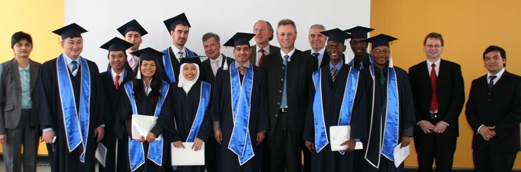
- Stilla U (2009-03-20) Presentation of President’s Award and congratulations at Gradiuation Cermony of Master’s Programme Land Management and Land Tenure. München, Bayrischer Bauindustrieverband
[Program][Photo01][Photo02][Photo03] - Reitberger J (2009-03-13) Benefit of airborne full waveform LIDAR for 3D segmentation and classification of single trees. ASPRS 2009 Annual Conference. USA, Baltimore
- Stilla U (2009-02-27) Full waveform airborne laser scanning: technology, data processing and applications. Switzerland, Zürich, ETHZ
- Stilla U (2009-02-09) Leitung der Arbeitskreissitzung: Photogrammetrie / mixed reality. 15. Internationale geodätische Woche. Österreich, Obergurgel
[Arbeitskreisthemen] - Hebel M (2009-01-29) Objektbasierte Koregistrierung von Laserscannerdaten bei der luftgestützten Erfassung urbaner Gebiete. 8. Oldenburger 3D-Tage, Oldenburg